The Maps of Ibrahim Miranda
- Gabriela Azcuy

- Apr 15
- 2 min read
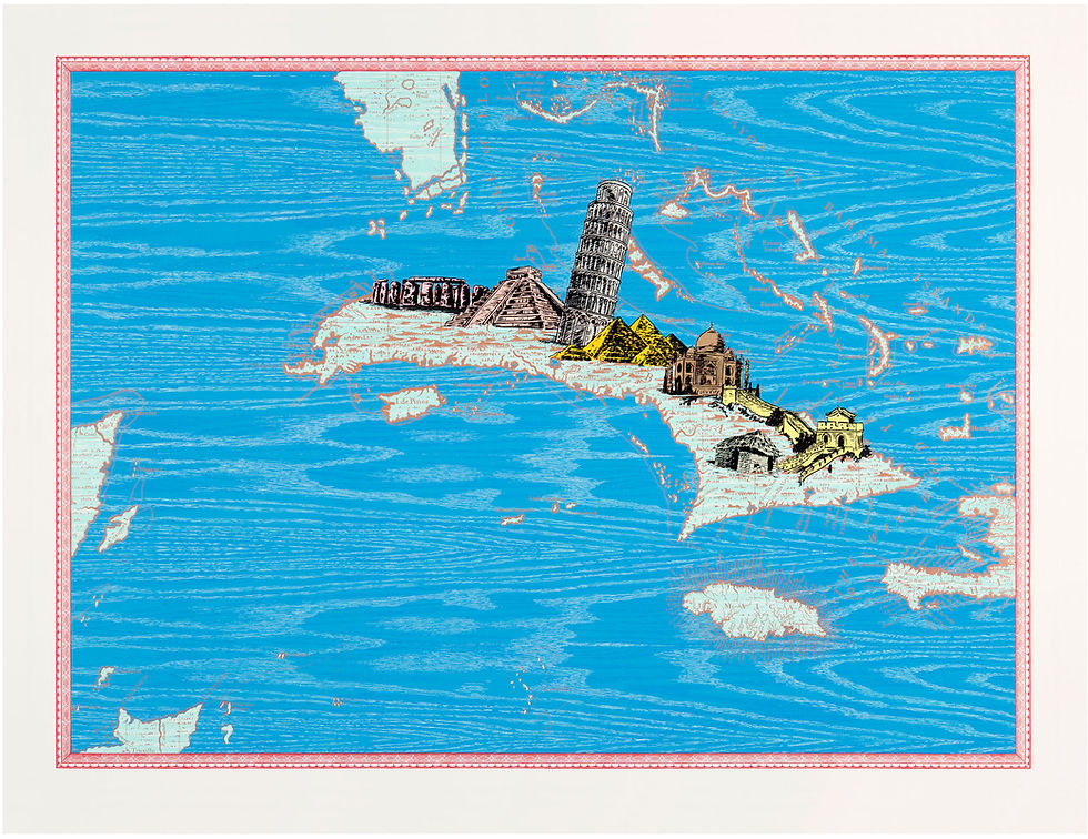
Ibrahim Miranda | Isla laboratorio o 7 maravillas (Island Laboratory or 7 Wonders), 2012 | 13 color screenprint / woodcut | 43 x 57in. | Published by Graphicstudio, University of South Florida. Photo: Will Lytch
Ibrahim Miranda (Cuba, 1969) is one of the key figures in the so-called renewal of Cuban printmaking that took place in the 1990s. From the early years of that decade, his practice challenged the traditional limits of the graphic medium through technical, conceptual, and spatial experimentation. The map series he began in 1992 stands as one of the most representative examples of this process of renewal.
Miranda has explained that his decision to work with maps arose circumstantially, while attempting to illustrate José Lezama Lima’s poem Noche insular. Jardines invisibles, in which Cuba is described in poetic, dynamic, and astral terms. Faced with this vision, he turned to the cartography of the island as a rational structure that could serve as a background for artistic intervention.
In these works, Miranda combined traditional techniques such as woodcut and silkscreen with nonconventional procedures, including drawing with Chinese ink and the use of extra-artistic materials. He also introduced a support foreign to the printmaking tradition: school geography maps. The reuse of these documents—already printed and laden with scientific information—together with the superimposition of textures and figurative elements, resulted in a visual language closer to painting.
This hybrid approach extended into the realm of installation. Miranda subverted the print’s conventional two-dimensional presentation through large panels arranged horizontally or in multiple directions, organized in series that could cover walls like tapestries. In this way, printmaking entered into dialogue with architectural space, incorporating elements such as doors or windows and creating tension between planimetry and spatial experience.
In relation to the notion of the multiple, the artist altered the traditional codes of printmaking*.
His maps form an open series, subject to constant intervention and conceived as an ongoing process rather than closed works or fixed editions. The cartography of Cuba became a poetic and symbolic catalyst, populated by anthropozoomorphic creatures, domestic objects, and references to mutation and insularity. By intervening in a scientific document, Miranda endowed it with an identitarian and critical dimension that he later extended to maps of the world, inviting viewers to perceive beyond the limits of cartography.
*Cfr. García Azcuy, Gabriela & García Herrera, Sandra. La renovación del grabado cubano en la década de los noventa (1990-1999) a través de la obra de Belkis Ayón, Sandra Ramos, Abel Barroso e Ibrahim Miranda. Undergraduate thesis in Art History, Universidad de La Habana, 2012.
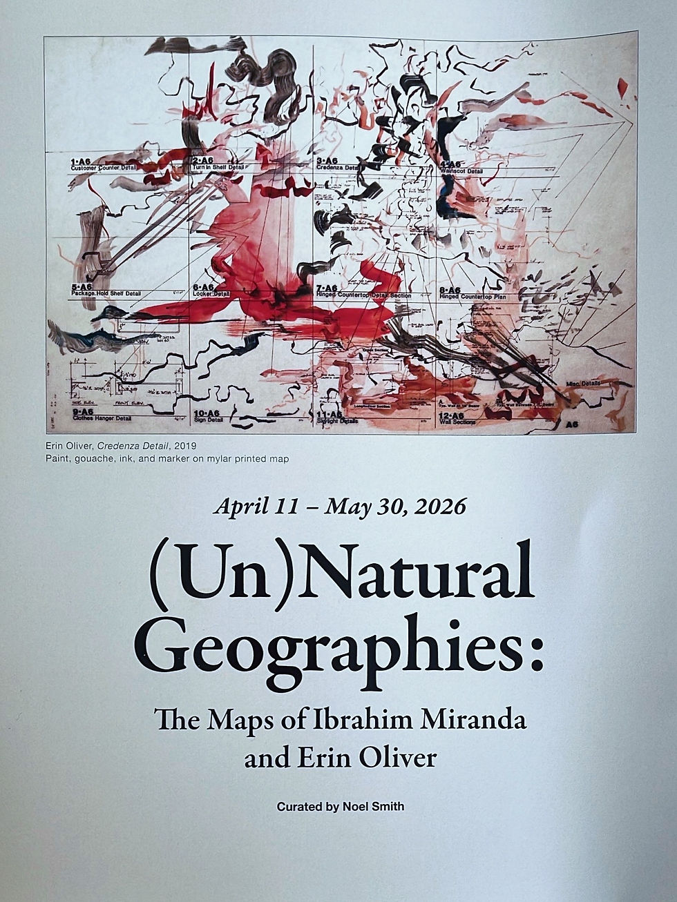
Cover of the catalogue for the exhibition (Un)Natural Geographies: The Maps of Ibrahim Miranda and Erin Oliver
This text was published in the catalogue of the exhibition (Un)Natural Geographies: The Maps of Ibrahim Miranda and Erin Oliver, curated by Noel Smith for Wild Space Gallery, St. Pete, Florida. See more at the following link: https://floridawildlifecorridor.org/exhibit/unnatural-geographies/


